TOOLS#1: NO PLACES 3/3
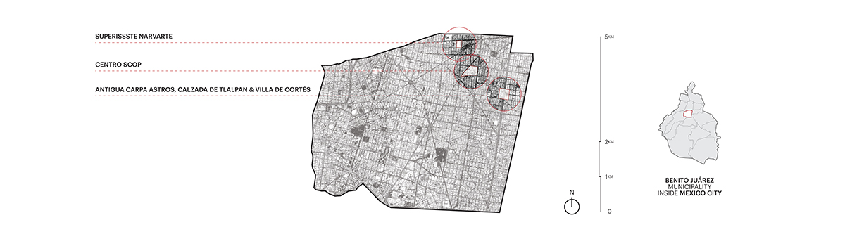
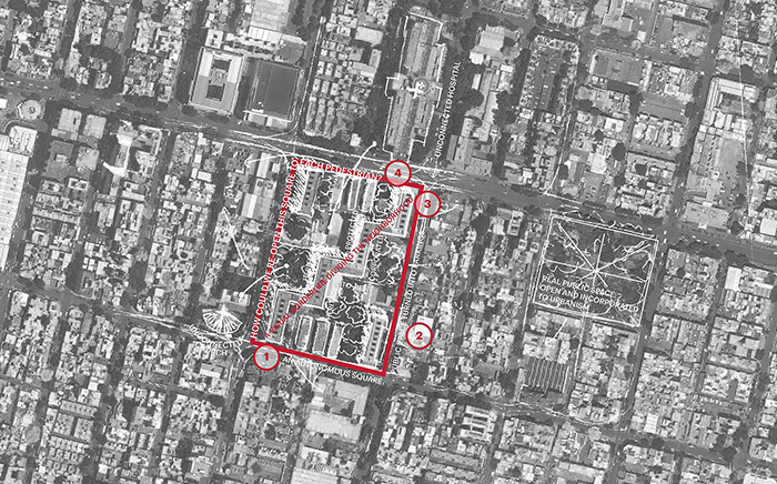
Mexico City, MexicoGROUP 3: NORTH-EAST PARTS OF BENITO JUÁREZ MUNICIPALITY - …
24 Oct 2018, Mexico City, Mexico
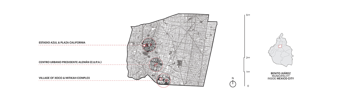
ESTADIO AZUL & PLAZA CALIFORNIA - Surroundings of Plaza México and “La Monumental” Fountain
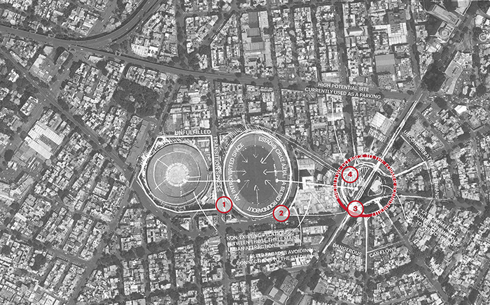
This area has a refined resonance in the history of urban planning in Colonia del Valle, the most relevant ‘bourgeois’ neighborhood of mid-twentieth century in Mexico City. To the west there are the only two existing structures from the old and unfinished “Ciudad de los Deportes” project: Plaza México –a monumental bullring– and Estadio Azul –a soccer stadium–. To the east, there are the remains of an important roundabout and public park, Plaza California –which was the elegant entrance of Insurgentes-San Borja residential development, back in 1940’s–, divided by Insurgentes Avenue.
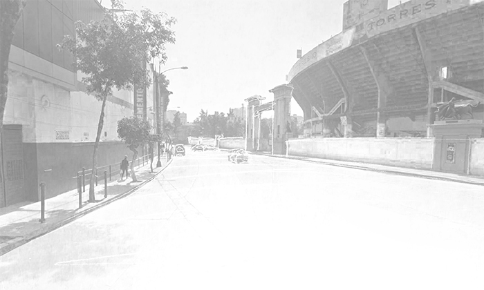
View 1 - nonexistent connection between the two stadiums.
Plaza México and Estadio Azul are all about introverted activity, and only on weekends. These are, so to speak, fortresses that attract huge crowds two days a week but look deserted at any other moment. Just two empty circuits: no reason or motivation for a pedestrian to enter. By the way: the Estadio Azul is already dead (sold): the property will be put to use as an enormous housing project. A great opportunity for a better habitat, or just another fortress?
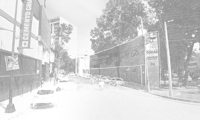
View 2 - the blind stadium surroundings become a parking lot on work days.
The streets surrounding these big public buildings are the backyard of a shopping mall facing Insurgentes Avenue (Suburbia). A parking lot, in practical terms. There are no real facades or side-streets, just temporary-use spaces and semi-confined strips.
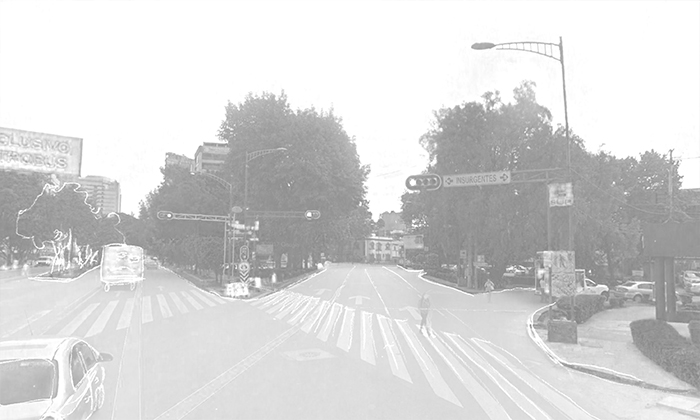
View 3 - there are no real pedestrian or cyclist facilities.
This is a hostile territory for a pedestrian or a cyclist: heavy traffic flow from all directions (cars, public transport-Metrobús). Insurgentes Avenue functions as a Great Divide between communities (Nochebuena to the west, San Borja to the east). And, somewhat hidden among these no-places, a once-great landmark: the monumental fountain of Plaza California. Should the roundabout be redesigned? Is it possible to reorganize the public space?
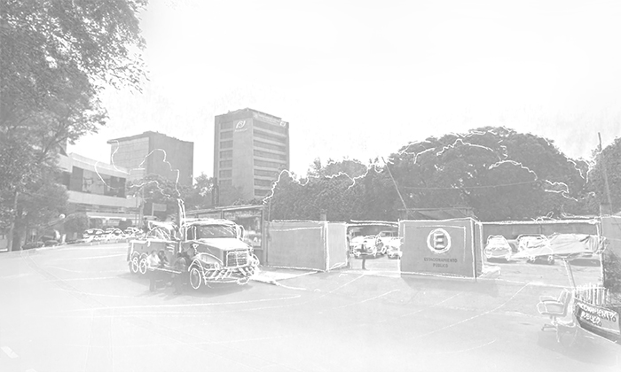
View 4 - the east half of the roundabout has been transformed into a parking lot.
If you walk south-bound, in the east sidewalk of Insurgentes Avenue, approaching Holbein street, fence is the only element you are able to see to your right. Behind that fence is a parking lot –and a yard used by the Metrobús workers: the definition of a no-place, indeed. And the perfect spot for a public park –an echo of the original one? The reinvention of a whole urban system in this area would be of great importance for the Municipality, and for Benito Juárez citizens.
CENTRO URBANO PRESIDENTE ALEMÁN (C.U.P.A.) - Renewed dignity for a landmark
This is a true Benito Juárez treasure: the first massive housing project in Mexico’s history. In the modern sense, that is: designed following the principles of international Functionalism. Over a thousand apartments, allocated in nine 13-story towers and six lower-rise buildings; green areas and public spaces covering 80% of the land. A brilliant formal study in Concentrated Habitats an Vertical Progressions, with an active and committed living community. C.U.P.A has endured the decades untouched –almost.
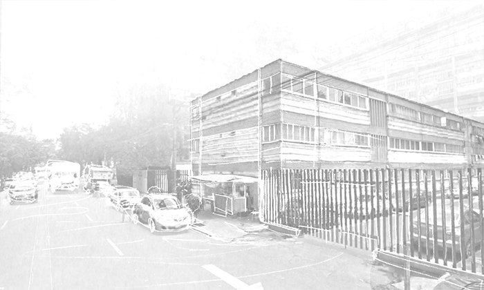
View 1 - it has always been an open complex. Now it’s closed.
Like the rest of Benito Juárez Municipality, C.U.P.A. and its surroundings are a crime-ridden area. The neighbors took, a few years ago, an extreme measure: to put their community behind bars. A fence now blocks every entrance to the complex. This has changed for the worse its public-space character and its urbanistic stance, so to speak. As a result, the habitat as a whole has deteriorated –and, paradoxically, has become more insecure.
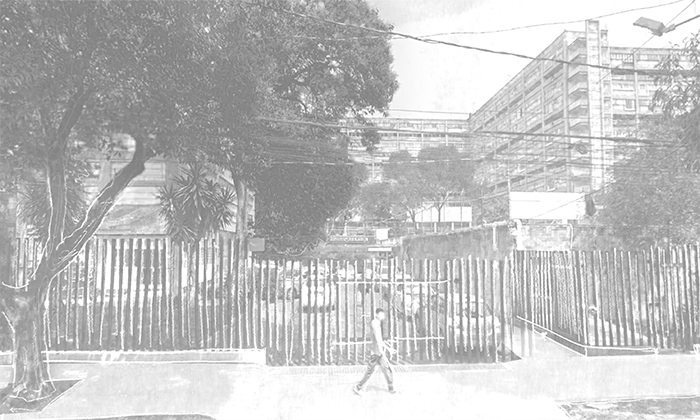
View 2 - no visual interaction from the streets.
What should be done? The fences must go, right? It’s not that simple. New and imaginative urban planning is needed to reanimate the neighbors’ economic activity and to restore the iconic drive of C.U.P.A.; its importance within Colonia del Valle, and its sense of community.
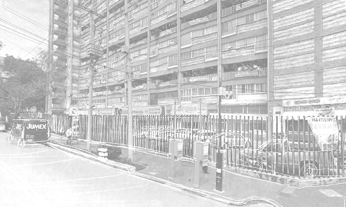
View 3 - what was supposed to be a public space became a private parking lot.
Indeed, C.U.P.A.’s original use is distorted. The fact that the almost all the street-facing courtyards have become closed and saturated parking lots is an obvious sign. Grocery stores, small shops and local businesses are, because of this, blocked, separated from life on the streets. Isolation is a general consequence.
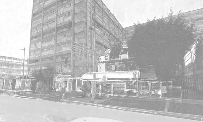
View 4 - architectural heritage as an anonymous background?
When Mario Pani built C.U.P.A in 1948, there were only farms and crop land in the area. He couldn’t have a feeling about the rich universe that would grow all around. Now designers, architects and urban planners must work together in order to restore not the icon, but an iconic and harmonious communal relationship.
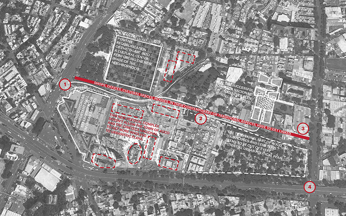
VILLAGE OF XOCO & MITIKAH COMPLEX - Degradation of pedestrian environment & a troubled urban identity
It looks like any other barrio: a modest array of old blocks, houses and a tiny church –in this case, Parroquia de San Sebastián–, encapsulated by modern-day development, in the southern tip of Benito Juárez Municipality. But is much more: Xoco is considered one of the pueblos originarios, villages that comprised indigenous settlement of the valley. This area is changing fast.
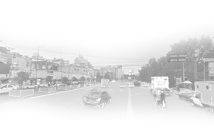
View 1 - crossing Universidad Avenue on foot: a dangerous option.
Universidad Avenue, to the west; Río Churubusco, to the south; Cuauhtémoc Avenue, to the east; Centro Bancomer, to the north. This quadrant has an intense pedestrian flow. Nevertheless, its walkability is a disaster, only made worse by the construction site of Mitikah, a huge real-estate development that includes massive housing, shopping malls, a hospital and office buildings.
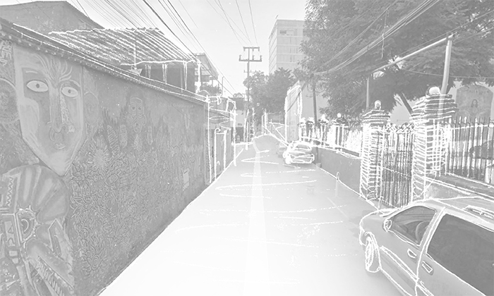
View 2 - pedestrians and cars, constantly struggling for space.
There is ‘natural’ corridor –in terms of User Experience– between the Coyoacán subway station and the very popular Cineteca Nacional. It is, in reality, a pitfall path. In some stretches, there’s no even a sidewalk: no protection against cars. A total absence of urban infrastructure. A lot of work and planning is needed in this area.
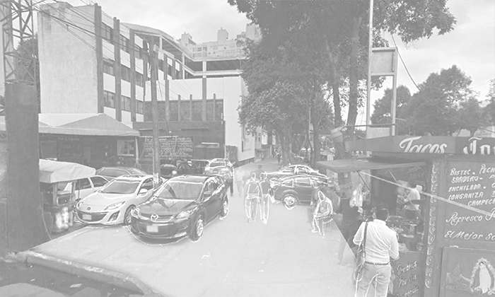
View 3 - the sidewalk, as in a lot of places in Mexico City, is no longer a pedestrian-exclusive space.
Mitikah will have, and already has, a huge impact. The project should include an extensive mitigation plan, but the challenge goes well beyond that: will the area become a collection of (even more) cloistered blocks, with a car-centered masterplan? Or the different habitats (Centro Bancomer, Cineteca Nacional, Mitikah, the village of Xoco, the municipal cemetery, Centro Cultural Roberto Cantoral…) will be somewhat integrated?
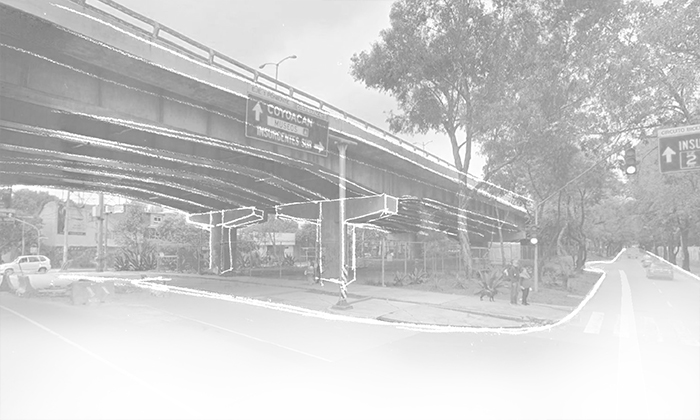
View 4 - despite the urban opportunity they represent, underbridge areas often become insecure spaces.
Talking about great opportunities: Centro Bancomer (one of the best examples of Mexican Brutalism), approaching the end of its life cycle, can have a beneficial new life, not just in terms of real-estate profit… Its green areas are perfect for public use. The underbridge commercial facilities in Río Churubusco can have a better use, also.
Transcript & Edition: Pablo García
Preliminary Research: Miguel Ángel Jiménez & Víctor Zúñiga
Graphic Design: Romain Roy-Pinot
Discussion Team: Carolina Arellano, Ana Laura Arista, Alberto Bautista Che, Raquel Cruz,
Pablo García, Miguel Ángel Jiménez, Romain Roy-Pinot & Víctor Zúñiga
GROUP 3: NORTH-EAST PARTS OF BENITO JUÁREZ MUNICIPALITY - …
When you walk the streets, when you shop in some mall of…